Attractions
The Legacy Tribute to be Held September 18 in Tulsa


Stan Reed (left) and Steve Pryor
Tulsa, Okla.– Aug. 26, 2016 Inspired by the recent passing of Tulsa blues master Steve Pryor and his bassist and friend, Stan Reed, The Legacy Tribute will take place at 5:30 PM on Sunday, September 18, 2016 at The Shrine, located at 18th and Boston, in Tulsa. The tribute will also honor Tulsa musician, Mike Bruce, who helped Steve Pryor hone his unique style along with other notable blues musicians who contributed to the Tulsa Sound.
Traveling to Tulsa for The Legacy Tribute will be the Mississippi-based Wayne Sharp Band, providing southern blues rock led by Hammond B3 maestro Wayne Sharp, backed by members of the “Allman Brothers Family Tree.” Sharp’s special guest will be drummer Karl Himmel, who has played with such notables as JJ Cale, Neil Young, Brenda Lee and Dr. John. Stan Reed toured with Sharp during the past few years.
Northwest Arkansas-based Earl and Them, featuring legendary guitarist Earl Cate, John Davies and Terry Cagle, will bring their unique brand of southern rock and blues to the stage in a rare Tulsa appearance.
In addition to the above special guests, the evening will be rounded out with performances by Oklahoma-based artists such as Scott Ellison, Don White with Casey Van Beek, Polly Ess, Connor Culpepper, David White, David Teegarden, John Hoff, Wanda Watson, Chuck Blackwell, Gary Gilmore, Randy Cunningham, Little Danny Baker, Jamie Oldaker and Larry Moss. Lloyd Price will be bringing and playing with The David Skinner Band, as well as band members Kevin Flint and Tim Smith.
The event will feature an opening set by the rock ‘n’ roll band Kalo, featuring Israeli singer/songwriter/guitarist Bat-Or Kalo with her sexy guitar rhythms, smoky vocals and a tease of blues and roots.
All proceeds from the evening will benefit The Red Dirt Relief Fund, a 501(c)3 non-profit organization providing a safety net of critical assistance for Oklahoma music people in times of need. Admission is $10 per person at the door (limited seating) or in advance by visiting stubwire.com. Available for purchase will be a special T-shirt commemorating the lives of Tulsa Sound Musicians who have passed, including beloved artists such as Flash Terry, Debbie Campbell, Gus Hardin, Carl Radle, and so many more. To assist in raising money for The Red Dirt Relief Fund, an original painting by artist Jeff Hogue will be raffled.
A unique portion of the evening will include a video montage of never before seen footage of Tulsa Sound musicians dating back to the 1960s. This archival footage, obtained from the private collection of famed videographer Larry Lieberman, will include behind the scenes and after-hours performances from iconic locations such as The Paradise Club. Footage will include Tulsa icons such as Elvin Bishop, Leon Russell and The Gap Band.
Food will be available provided by the newly formed Epicurean Eats Food Truck with Chef Steve Ellsworth. The menu will offer both smoked meats and vegetarian entrees.
More details about the event are available on Facebook under the event name: The Legacy Tribute.
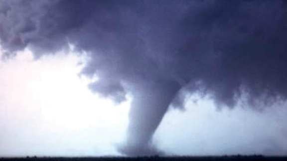
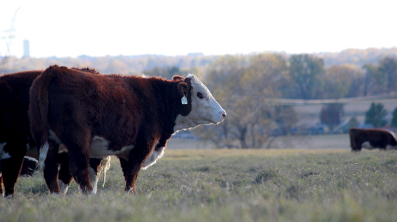
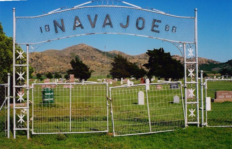
Southwestern Oklahoma is rich with history and has a beautiful, rugged landscape. A lesser known mountain range, the Navajo Mountains sits in eastern Jackson County, just to the north east of Altus.
There, at the base of those mountains, used to be the town of Navajoe. It’s easy to surmise that the town took its name from the nearby mountains. As a side note, from my research, it seems that the Navajo Mountains got their name because of a failed Navajo raid. According to folklore, the Navajos attempted to steal Comanche horses, and were annihilated by the Comanches. Legendary Comanche Chief Quanah Parker gave a detailed account of a similar failed Navajo raid in 1848 or 1849, against his village in Elk Creek just north of the mountains.
Approximately 40 years later, in 1886 when the area was still part of Greer County, Texas, two men named W.H. Acers and H.P. Dale opened a general store in the area. The next year, “Buckskin Joe” Works, a Texas land promoter, attended a Fourth of July picnic in the area. The celebration included settlers, cowboys, and several Comanches led by Quanah Parker.
That same year, the town received a post office designated as “Navajoe” to avoid confusion to Navajo, Ariz. Around the same time the Navajoe school opened, and a couple churches were founded.
Eventually the town was home to more than 200 families, and had a booming trade center, complete with grocery stores, hardware stores, saloons, a blacksmith, a dry goods store, a hotel, and a cotton gin. It was a regular frontier time.
Unfortunately, in 1902, the railroad eventually bypassed Navajoe, ensuring its demise, as most businesses moved – buildings and all. Less than two decades later the Navajoe School was consolidated with Friendship and other school districts. Now, all that remains of the town is a small cemetery at the foot of the mountains. A granite monument, which was fashioned in 1976, pays tribute to the old town.
Eventually, in the mid-1960s, Friendship and Warren schools consolidated. The new school, which graduated its first class in 1964 and is still active in Jackson County, is called Navajo.
Read more in the February 2020 issue of Oklahoma Farm & Ranch.
Sources
Wikipedia.com
RedDirtChronicles.com
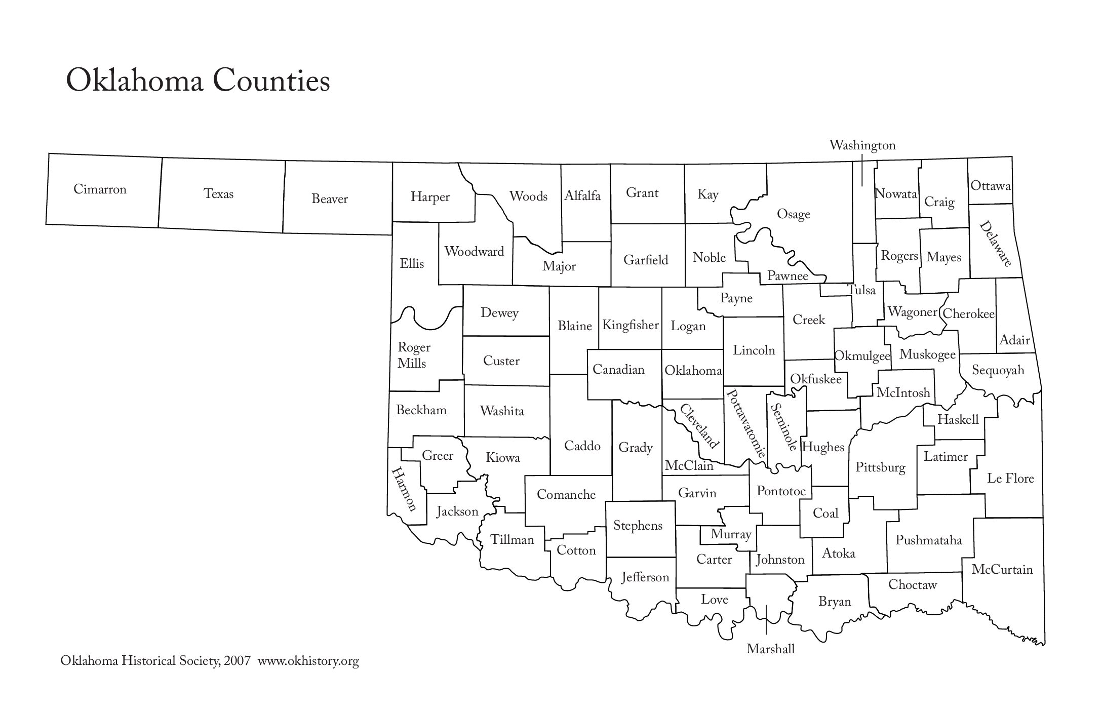
Each spring, Oklahomans can regularly be found listening to the radio or watching the television as weathermen and women report severe weather locations. Counties are typically used to identify storm locations, and while some names are easy to understand, others make us wonder.
While Oklahoma is ranked twentieth in size, it is seventeenth in the number of counties with 77. When it was first organized as the Oklahoma Territory, it had seven, which were designated numerically. When additional counties were added, they were given letters of the alphabet. When Oklahoma became a state in 1907, all the counties were renamed, with only two additional counties being added after statehood.
Oklahoma has 13 counties named for Indian tribes, and well-known Indian families have provided names for eight other counties. Six counties are named for U.S. Presidents, while rivers provided names for four counties. Military officers and Indian leaders are also honored.
Read on to learn what we found out about the etymology of our state’s counties.
Adair County was specifically named for Watt Adair, one of the first Cherokees to settle in the area.
Alfalfa County was formed at statehood as Woods County. The county is named after William H. “Alfalfa Bill” Murray, the president of the Oklahoma Constitutional Convention and ninth governor of Oklahoma.
Atoka County honors a Choctaw Chief named Atoka.
Beaver County was given because of the presence of many beaver dams on the Beaver River, which runs through the area.
Beckham County was named for J. C. W. Beckham, who was Governor of Kentucky and the first elected member of the U.S. Senate.
Blaine County is the birthplace of voice actor Clarence Nash, the voice of Disney’s Donald Duck. It is named for James Blaine, the Secretary of State under President Harrison.
Bryan County was named for Democratic politician William Jennings Bryan.
Caddo County was named for the Caddo tribe who were settled here on a reservation in the 1870s.
Canadian County in the central part of the state is named for the Canadian River.
Carter County was named for Captain Ben W. Carter, a Cherokee who lived among the Chickasaw.
Cherokee County is named for the Cherokee Indian Nation.
Choctaw County’s name is derived from Chahta, the mythical founder of the Choctaw people.
The westernmost county in the state, Cimarron County contains the only community in the state that observes the Mountain Time Zone and is named for the Cimarron River.
Cleveland County was named after U.S. President Grover Cleveland.
Coal County was named for the mineral that was then the major product of the region.
Comanche County was named for the Comanche tribe.
At statehood, the area which is now Cotton County fell within the boundaries of Comanche County. It split off in 1912, becoming the last county created in the state; it was named for the county’s primary crop.
Craig County was named for Granville Craig, a prominent Cherokee farmer who lived in the Bluejacket area.
Creek County got its name from the Creek Nation, whose country following Indian removal included the county.
Custer County was named in honor of General George Armstrong Custer.
Delaware County was named for the Delaware Indians who had established a village in the area prior to the arrival of the Cherokees in Indian Territory in the 1830s.
Originally created in 1891 as “County D,” voters in an 1898 election chose the name Dewey County, honoring Admiral George Dewey.
Ellis County was named for Albert H. Ellis, vice president of the 1906 Constitutional Convention.
Garfield County was named after President James Garfield. Prior to the Land Run of 1893, Garfield County was named O County.
Garvin County was named for Samuel J. Garvin, a local Chickasaw rancher, merchant and banker.
Grady County was named for Henry W. Grady, an editor of the Atlanta Constitution and southern orator.
Grant County was named County L in Oklahoma Territory at the time of its opening to non-Indian settlement. A county election renamed it for U.S. President Ulysses S. Grant.
Greer County is named for Texas stateman and Lieutenant Governor of Texas John Greer.
Harmon County takes is name for Judson Harmon, governor of Ohio and U.S. Secretary of State.
Harper County was created from the northwestern part of Woodward County and named for Oscar Green Harper, who was clerk of the Oklahoma Constitutional Convention.
Haskell County is named in honor of Charles N. Haskell, who was the first governor of Oklahoma.
Hughes County was named for W. C. Hughes, an Oklahoma City lawyer who was a member of the Oklahoma Constitutional Convention.
It’s unknown which Jackson Jackson County was named for: President Andrew Jackson or Confederate General Stonewall Jackson.
Jefferson County was created at statehood and named in honor of President Thomas Jefferson.
Johnston County was named for Douglas H. Johnston, a governor of the Chickasaw Nation.
Kay County was originally designated as county “K.” Kay County is the only county to keep its same name as the Oklahoma area moved from a territory to a state.
Kingfisher County was formed in 1890 and named Kingfisher by a vote of residents.
Kiowa County was named for the Kiowa people.
Latimer County was created at statehood and named for James Latimer, a delegate to the state Constitutional Convention.
Le Flore County honors a Choctaw family of French descent named LeFlore.
Lincoln County was named for Abraham Lincoln, the sixteenth president of the United States.
Logan County was named for John Logan, Federal general in the War Between the States, and a U.S. Senator from Illinois.
Love County was named for Overton Love, a prominent Chickasaw farmer, entrepreneur and politician. His descendants built the nationwide Love’s Travel Stops.
Major County was named for John Major, a member of the Oklahoma Constitutional Convention.
Marshall County was named to honor the maiden name of the mother of George Henshaw, a member of the Oklahoma Constitutional Convention.
Mayes County took its name for Samuel Houston Mayes, a teenage Confederate cavalryman, and mixed-blood Principal Chief of the Cherokee Nation.
McClain County pays homage to Charles M. McClain, an Oklahoma constitutional convention attendee.
McCurtain County was named for an influential Choctaw family that lived in the area.
McIntosh County is named for an influential Muscogee Creek family whose members led the migration of the Lower Towns to Indian Territory and served as leaders for generations.
Murray County was named for William H. Murray, president of the Oklahoma Constitutional Convention and later a Governor of Oklahoma.
Muskogee County was named for the Muscogee (Creek) Nation. The official spelling of the name was later changed to Muskogee.
Originally designated as County P, Noble County was renamed for John Willock Noble, then the United States Secretary of the Interior.
Nowata County’s nameis derived from a Delaware word “no-we-ata,” meaning “come here” or “welcome.”
Okfuskee County is named for a former Muscogee town in Alabama, from which the Creek were removed to Indian Territory, that in turn was named for the Okfuskee, a Muscogee tribe.
Oklahoma County is one of seven counties in the United States to share the same name as the state it is located in (the other six counties are Arkansas County, Hawaii County, Idaho County, Iowa County, New York County, and Utah County), and the only one of the seven to contain the state capital.
Okmulgee County is named after a Creek town of the same name in Alabama, from which the Creek were removed to Indian Territory. The name Okmulgee is derived from the word okimulgi, meaning “boiling waters.
Osage County is the largest county by area in the state and is named for and is home to the federally recognized Osage Nation.
Ottawa County was named for the Ottawa Tribe of Oklahoma.
Pawnee County is named for the Pawnee tribe, which settled in the area following the War Between the States.
Payne County was named for Capt. David L. Payne, a leader of the “Boomers.”
Pittsburg County got its name because county leaders believed that its coal production compared favorably with Pittsburgh, Pennsylvania, at the time of statehood.
Pontotoc County was named for an historic Chickasaw tribal area in Mississippi.
Pottawatomie County got its name for the tribe that lived in the area. It’s name is a Chippewa term that means “people of the place of the fire.”
Pushmataha County was named for Pushmataha, an important Choctaw chief in the American Southeast.
Roger Mills County got its name for Confederate office and U.S. senator from Texas.
The area of Rogers County was named the Cooweescoowee District at the time of statehood, but the residents protested. It was renamed for Clem Vann Rogers, a prominent Cherokee rancher and father of Will Rogers.
Seminole County is named for the Seminole Nation, whose capital is also the county seat of Wewoka.
Sequoyah County was named to honor legendary statesman and creator of the Cherokee syllabary, which brought literacy to the Cherokee Nation.
Stephens County was named for Texas politician John Hall Stephens, who championed for Oklahoma statehood.
Texas County was named for its neighbor to the south.
Tillman County was named for U.S. Senator Benjamin Tillman of South Carolina.
Tulsa County was named after the previously established city of Tulsa and the Creek village of Tulsey Town in Alabama.
Wagoner County is named for the county seat of the same name, which derived from Henry “Big Foot” Parsons.
Named for President George Washington, Washington County is the second smallest county in Oklahoma.
Washita County is named for the almost 300-mile long river that runs through it and empties into Lake Texoma and the Red River.
Woods County was named after Samuel Newitt Wood, a renowned Kansas activist, legislator, and newspaper publisher.
Woodward County was originally known as “N” County and was composed of present-day Woodward County and portions of Harper, Ellis, and Woods County. It is unknown exactly whom the county (and the town) is named after, but the two leading candidates are Brinton W. Woodward, a Santa Fe railway director, or Richard Woodward, a buffalo hunter.
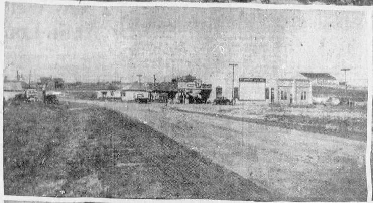
By the time April settles in across Oklahoma, you can feel the change coming.
The air gets heavier. The wind shifts. Clouds start building in a way that makes you pay attention. And sooner or later, the rains come.
At first, it’s welcome. Pastures green up almost overnight. Stock tanks catch water again. Dust that’s hung in the air for months finally settles. But in Oklahoma, rain has never come without a little hesitation. Because as much as you need it, you also know what it can do.
Too little, and you’re watching grass fade before summer even gets started. Too much, and creeks spill over, low crossings disappear, and rivers remind you just how wide they can get when they want to.
That push and pull—between drought and flood—is what shaped this state long before most of its lakes ever existed. Because the truth is, Oklahoma wasn’t always a place defined by water.
It was a place defined by uncertainty.
Before dams were built, rivers like the Red River and the Arkansas River didn’t follow a dependable pattern. They spread wide and shallow across sandbars during dry stretches, then turned around and flooded everything in reach when heavy rains set in. Smaller creeks followed the same pattern, running dry one season and cutting through fields the next.
For the people trying to make a living on that land, there wasn’t much room for error. A wet spring could wash out crops. A dry summer could leave livestock without reliable water. There wasn’t a system to balance it. You took what came and dealt with the consequences.
By the early 1900s, the consequences were getting harder to ignore. Flooding events damaged towns and farmland across southern Oklahoma, and then, just a couple of decades later, the problem flipped entirely. The Dust Bowl exposed how quickly the state could swing in the opposite direction. Water that had once been destructive became scarce enough to threaten everything from crops to daily survival.
That stretch of years made one thing clear. If Oklahoma was going to grow, it couldn’t keep relying on chance.
Water had to be managed.
Starting in the 1930s, that management took shape in the form of dams. Large-scale projects, led primarily by the U.S. Army Corps of Engineers and the Bureau of Reclamation, began to change the landscape of the state in a way that’s still visible today.
The goal wasn’t simply to create lakes. It was to solve multiple problems at once—control flooding, store water for dry periods, supply growing towns, and in some cases generate hydroelectric power.
Projects like Lake Texoma, completed in 1944, and Lake Eufaula, completed in 1964, reshaped entire regions. Grand Lake O’ the Cherokees, finished in 1940, brought electricity to rural communities while also becoming a long-term water resource.
But those lakes didn’t appear on empty ground.
Before the water rose, land had to be cleared. Timber was cut. Structures were moved. Roads were rerouted. In some cases, entire communities were relocated to higher ground. Families left land that had been theirs for generations, knowing it would soon sit under water.
Even with all that work, not everything could be removed. And when lake levels drop during drought years, pieces of what was there before have a way of showing themselves again—old foundations, fence lines, stretches of road that don’t lead anywhere anymore.
It’s easy to forget that part when the water is full and calm, but it’s there.
What followed, though, is what most people recognize today. The lakes became part of everyday life in Oklahoma. They provided more dependable water for agriculture and livestock. They supported growing towns and industries. And over time, they turned into places people chose to spend their time—fishing, boating, gathering on summer weekends along shorelines that didn’t exist a century ago.
What started as a solution became something much bigger.
And even now, those lakes are doing exactly what they were built to do. They catch the heavy rains when they come. They hold water through the dry stretches. They give the state a level of stability it didn’t have before.
Because the same cycle still exists. The rains come in April. The heat follows. And somewhere between the two, Oklahoma continues to rely on a system that was built to handle both.
Sidebar: What’s Under the Water?
There’s a reason people sometimes hesitate when they think too hard about what’s beneath Oklahoma’s lakes.
Because it’s not just water.
Under lakes like Lake Texoma and Lake Eufaula are the remains of what used to be there:
- Old home sites and foundations
- Roads and bridge approaches
- Fence lines and property boundaries
- Tree stumps and submerged timber
- Wells, cellars, and farm structures
Most areas were cleared before flooding, but with that much ground to cover, it was never complete.
When water levels drop, some of it comes back into view. The rest stays hidden.
It’s not something most people think about while they’re out on the water. But once the thought crosses your mind, it tends to stick.



-
 Country Lifestyle2 years ago
July 2017 Profile: J.W. Hart
-
 Farm & Ranch2 years ago
From Plow to Plentiful: The Most Important Inventions in Agricultural History
-
 Attractions9 years ago
48 Hours in Atoka Remembered
-
 Equine9 years ago
Umbilical Hernia
-
 Country Lifestyle5 years ago
The Two Sides of Colten Jesse
-
 Outdoors9 years ago
Grazing Oklahoma: Honey Locust
-
 Farm & Ranch8 years ago
Hackberry (Celtis spp.)
-
 Equine6 years ago
On the Road with Emily Miller-Beisel